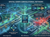
Spatial-Temporal Graph Neural Networks: Mapping and Predicting Urban Mobility Anomalies
Traditional machine learning algorithms excel at processing structured, tabular data. Even deep learning architectures like Convolutional Neural Networks (CNNs) have revolutionized how we process grid-like structures like images. But when it comes to the fluid, interconnected, and dynamic nature of a city, traditional models hit a wall.
A city’s transport network isn’t a grid or a static table. It is a living, breathing graph.
To model how people, bicycles, and vehicles move through an urban environment—and more importantly, to predict anomalies like sudden traffic bottlenecks, accidents, or peak transit spikes—we need an architecture designed for interconnected networks.
Enter Spatial-Temporal Graph Neural Networks (ST-GNNs).
2. Why Traditional Models Fail in Urban Mobility
In urban planning and logistics, predicting traffic flow or pedestrian density has historically relied on time-series forecasting models (like ARIMA or LSTM). While these models are great at capturing temporal patterns (e.g., “traffic always spikes at 6:00 PM on this specific avenue”), they are completely blind to spatial relationships.
If an accident occurs on Avenue A, it will inevitably cause a ripple effect of congestion on neighboring streets B, C, and D.
A traditional time-series model treats each street as an isolated sensor. It cannot natively understand that Avenue A and Street B are physically connected.
Conversely, standard spatial models can capture proximity but fail to grasp how congestion cascades over time. To solve this, ST-GNNs combine the spatial-feature extraction of Graph Neural Networks (GNNs) with the temporal-sequence learning of Recurrent Neural Networks (RNNs) or Temporal Convolutional Networks (TCNs).
3. Under the Hood of ST-GNNs: Space meets Time
To model urban mobility, we represent the city as a graph:
$$G = (V, E)$$
- Vertices ($V$): The nodes, which represent physical locations, such as intersections, bike-sharing stations, or roadside IoT sensors.
- Edges ($E$): The connections between nodes, representing the streets, bike lanes, or transit routes linking them.
At each time step $t$, every node possesses a feature vector (e.g., current speed, vehicle count, weather conditions). The ST-GNN processes this complex web of data through two main layers:
- Spatial Graph Convolution: This layer uses neighborhood aggregation (or message passing). Each node “talks” to its connected neighbors, sharing its current state. If a bike lane is reaching maximum capacity, the adjacent intersections instantly receive this “signal” in the mathematical representation.
- Temporal Gated Convolution: Once the spatial features are aggregated, the temporal layer analyzes how these states evolve over consecutive time slices.
By stacking these spatial and temporal layers, the network learns the hidden structural dynamics of the city, enabling it to predict mobility patterns not just minutes, but hours in advance.
4. Predicting Anomalies and Protecting Vulnerable Road Users
One of the most powerful applications of ST-GNNs is the dynamic prediction of safety anomalies, particularly for vulnerable road users like cyclists and pedestrians.
- Conflict Prediction at Intersections: By ingestings real-time telemetry from active mobility sensors (such as LiDAR or smart cameras at bike crossings), ST-GNNs can predict near-miss collision probabilities within milliseconds, allowing smart city infrastructure to proactively adjust signal timing.
- Active Mobility Flow Optimization: Instead of reactive infrastructure planning, cities can run predictive simulations to see how adding a new cycling corridor will redistribute micro-mobility traffic across the entire urban graph, preventing bottleneck anomalies before construction even begins.
- Dynamic Re-routing: Empowering navigation engines to route active commuters away from streets predicted to experience heavy freight traffic spikes in the next 15 minutes.
5. The Paradigm Shift: From Reactive to Predictive Cities
Transitioning to ST-GNN architectures allows data scientists to move away from historical patching. We no longer have to analyze why a traffic jam occurred after everyone is already stuck in it.
By treating the city as an interconnected, dynamic graph, we unlock the ability to forecast the heartbeat of urban movement. In the quest to build safer, more efficient, and livable cities, spatial-temporal graph modeling is the mathematical engine driving the future of smart mobility.
References (International Standard)
- YU, B.; LI, H.; ZHU, Z. Spatio-Temporal Graph Convolutional Networks: A Deep Learning Framework for Traffic Forecasting. In: Proceedings of the 27th International Joint Conference on Artificial Intelligence (IJCAI), p. 3634-3640, 2018.
- LI, Y.; YU, R.; SHAHABI, C.; LIU, Y. Diffusion Convolutional Recurrent Neural Network: Data-Driven Traffic Forecasting. International Conference on Learning Representations (ICLR), 2018.
- ZHAO, L.; SONG, Y.; ZHANG, C. Spatio-Temporal Graph Neural Networks for Active Mobility and Vulnerable Road User Safety: A Review. IEEE Transactions on Intelligent Transportation Systems, v. 26, n. 2, p. 112-128, 2025.